Photo of Day

If words are cheap, photographs in the age of digital cameras are even cheaper. Here's a running posting of watershed relevant photos.

Jun 28, 2009

Sky view

No comments:

Jun 27, 2009

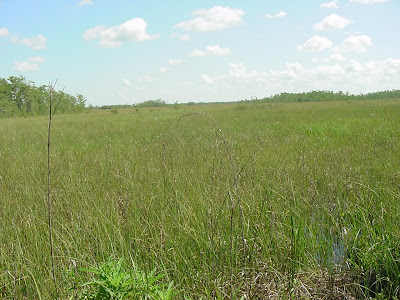
Ground view

No comments:

Jun 26, 2009

Scenic prairie

No comments:

Jun 25, 2009

Cypress and water

No comments:

Low tide

No comments:

Jun 24, 2009

Sea bean

No comments:

Jun 23, 2009

Tidal critter

No comments:

Jun 22, 2009

Gulf of Mexico

No comments:

Jun 21, 2009

Tidal pool

No comments:

Jun 20, 2009

Earlier in May

No comments:

Jun 19, 2009

Fresh/salt barrier

No comments:

Jun 18, 2009

Faka Union Weir

No comments:

Sea of Okeechobee

No comments:

Jun 17, 2009

Sea of sugar

No comments:

Jun 16, 2009

Florida clouds

No comments:

Jun 15, 2009

S-3

No comments:

Jun 14, 2009

Red means stop

No comments:

Jun 13, 2009

Green means go

No comments:

Jun 12, 2009

Clouds over Lake O

No comments:

Jun 11, 2009

Rim Canal

No comments:

Jun 10, 2009

S-310

No comments:

Jun 9, 2009

Sugar cane

No comments:

Jun 8, 2009

North of river

No comments:

Jun 7, 2009

Caloosahatchee waterway

No comments:

Jun 6, 2009

Cross river delivery

No comments:

Jun 5, 2009

LaBelle Bridge

No comments:

Jun 4, 2009

Caloosahatchee at LaBelle

No comments:

Jun 3, 2009

River sign

No comments:

Jun 2, 2009

Tailwater gage

No comments:

Jun 1, 2009

Old gage

No comments:
Newer Posts Older Posts Home
Subscribe to: Posts (Atom)

Submit your photos!

Submit your watershed photos to robert_sobczak@nps.gov. Please include your name, a brief caption, and when the photo was taken.

View Photo Archive

  • ►  2010 (2)
    • ►  June (2)
  • ▼  2009 (181)
    • ▼  June (30)
      • Sky view
      • Ground view
      • Scenic prairie
      • Cypress and water
      • Low tide
      • Sea bean
      • Tidal critter
      • Gulf of Mexico
      • Tidal pool
      • Earlier in May
      • Fresh/salt barrier
      • Faka Union Weir
      • Sea of Okeechobee
      • Sea of sugar
      • Florida clouds
      • S-3
      • Red means stop
      • Green means go
      • Clouds over Lake O
      • Rim Canal
      • S-310
      • Sugar cane
      • North of river
      • Caloosahatchee waterway
      • Cross river delivery
      • LaBelle Bridge
      • Caloosahatchee at LaBelle
      • River sign
      • Tailwater gage
      • Old gage
    • ►  May (30)
    • ►  April (29)
    • ►  March (32)
    • ►  February (28)
    • ►  January (32)
  • ►  2008 (169)
    • ►  December (31)
    • ►  November (30)
    • ►  October (31)
    • ►  September (30)
    • ►  August (31)
    • ►  July (16)
  • ►  2007 (14)
    • ►  November (3)
    • ►  October (5)
    • ►  September (5)
    • ►  August (1)
Hi,my name is Bob.

I am a National Park Service hydrologist at Big Cypress National Preserve who works in collaboration with Florida Gulf Coast University, the Big Cypress Basin, and the multi-agency Big Cypress Watersheds Team.

The journal is your daily passport into the inner realm of south Florida's water cycle and interconnected watersheds -- a narrative voice into the watery wilderness of aquatic south Florida.

I make no claim to knowing everything, just enough worthsharing. Click here to find out more about the journal, or dig into the running list of posts.

Feel free to call or email me if you would like more information, or to be added to the journal's weekly mailing list. Otherwise, have fun reading -- and remember -- always be good to your watershed!

Sincerely,

Robert V. Sobczak
robert.v.sobczak@gmail.com
239-695-1151

Welcome to The South Florida Watershed Journal

Welcome to The South Florida Watershed Journal
Picture Window theme. Theme images by sbayram. Powered by Blogger.